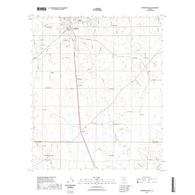
2020 Map of Jonesboro South
USGS Topo · Published 2020About this map
The Jackson Parish Courthouse stands as the civic anchor of this north Louisiana landscape, surrounded by the street grid of Jonesboro. This 2020 record of the region captures a territory defined by timbered hills and the winding courses of Bear Cr, Garrett Cr, and Antwine Cr. Moving south from the town center along the highway, the small community of Wyatt sits at a junction of local roads, while Gansville marks the southern reach near the boundary with Winn Parish.
Find a feature on this map
99 named features on this map. Tap any name to fly to it.
Don’t see what you’re looking for? This feature index may not catch every label — zoom into the map to look around manually.
Map Details
Editions of this 2020 Jonesboro South Map
This is the sole edition of this map. No revisions or reprints were ever made.
Other maps of this area

1947 · Goldonna
USGS Topo · 1:62,500

1947 · Bienville
USGS Topo · 1:62,500

1949 · Bienville
USGS Topo · 1:62,500

1949 · Jonesboro
USGS Topo · 1:62,500

1950 · Jonesboro
USGS Topo · 1:62,500

1953 · Hodge
USGS Topo · 1:62,500

1955 · Shreveport
USGS Topo · 1:250,000

1956 · Shreveport
USGS Topo · 1:250,000

1957 · Goldonna
USGS Topo · 1:62,500

1984 · Shreveport
USGS Topo · 1:250,000