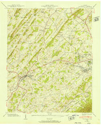
1939 Map of Jonesboro
USGS Topo · Published 1952About this map
Jonesboro, the historic county seat of Washington County, serves as the focal point of this 1939 survey. The landscape is defined by the prominent Buffalo Ridge and Chestnut Ridge to the north, while the Andrew Johnson Highway and the Southern Railway provide critical east-west transit through the valley. This era reveals a densely populated rural landscape characterized by numerous country schools and churches, including Berea Sch, McNeil Sch, and Marvin Chapel.
Find a feature on this map
75 named features on this map. Tap any name to fly to it.
Don’t see what you’re looking for? This feature index may not catch every label — zoom into the map to look around manually.
Map Details
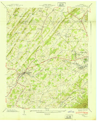
Editions of this 1939 Jonesboro Map
2 editions found
Other maps of this area

1891 · Roan Mountain
USGS Topo · 1:125,000

1892 · Greeneville
USGS Topo · 1:125,000

1894 · Roan Mountain
USGS Topo · 1:125,000

1896 · Greeneville
USGS Topo · 1:125,000

1904 · Roan Mountain
USGS Topo · 1:125,000

1904 · Greeneville
USGS Topo · 1:125,000

1935 · Sullivan Gardens
USGS Topo · 1:24,000

1935 · Leesburg
USGS Topo · 1:24,000

1935 · Erwin
USGS Topo · 1:24,000

1935 · Spurgeon
USGS Topo · 1:24,000