
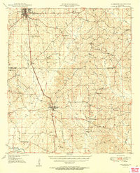
1950 Map of Jonesboro
USGS Topo · Published 1950About this map
Jonesboro serves as the northern anchor of this mid-century survey, situated at the junction of several transit lines including the Chicago Rock Island and Pacific railroad. The line runs south through Wyatt and Dodson, carving a path through the timber-rich landscape of Jackson Parish and Winn Parish. This region is defined by a dense network of rural infrastructure, where small community centers are marked by country churches and schools like Mt Hebron Sch and Gaars Mill Sch.
Find a feature on this map
46 named features on this map. Tap any name to fly to it.
Don’t see what you’re looking for? This feature index may not catch every label — zoom into the map to look around manually.
Map Details
Editions of this 1950 Jonesboro Map
2 editions found
Other maps of this area

1947 · Goldonna
USGS Topo · 1:62,500

1947 · Bienville
USGS Topo · 1:62,500

1949 · Calvin NE
USGS Topo · 1:31,680

1949 · Bienville
USGS Topo · 1:62,500

1949 · Jonesboro
USGS Topo · 1:62,500

1950 · Winnfield
USGS Topo · 1:62,500

1951 · Winnfield
USGS Topo · 1:62,500

1953 · Chatham
USGS Topo · 1:62,500

1953 · Hodge
USGS Topo · 1:62,500

1953 · Alexandria
USGS Topo · 1:250,000