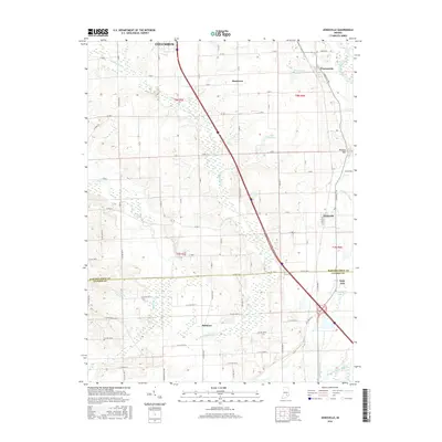
2016 Map of Jonesville
USGS Topo · Published 2016About this map
Jonesville and the southern outskirts of Columbus define this portion of the Indiana landscape where the Bartholomew and Jackson County line crosses a complex network of waterways. The East Fork White River and its accompanying wetlands, including Thompson Slough and Peters Lake, create a riparian corridor that has historically dictated the placement of small clusters like Little Acre and Bobtown. The terrain is generally level, with the exception of Wrights Hill rising to the east, providing a clear view of how the land transitions from the valley floor toward higher ground.
Find a feature on this map
80 named features on this map. Tap any name to fly to it.
Don’t see what you’re looking for? This feature index may not catch every label — zoom into the map to look around manually.
Map Details
Editions of this 2016 Jonesville Map
This is the sole edition of this map. No revisions or reprints were ever made.
Other maps of this area

1942 · Franklin
USGS Topo · 1:125,000

1942 · Columbus
USGS Topo · 1:125,000

1948 · New Bellsville
USGS Topo · 1:24,000

1948 · Waymansville
USGS Topo · 1:24,000

1953 · Cincinnati
USGS Topo · 1:250,000

1953 · Indianapolis
USGS Topo · 1:250,000

1956 · Indianapolis
USGS Topo · 1:250,000

1956 · Vincennes
USGS Topo · 1:250,000

1956 · Louisville
USGS Topo · 1:250,000

1957 · Indianapolis
USGS Topo · 1:250,000