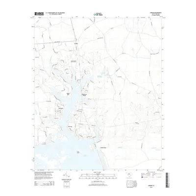
2014 Map of Jordan
USGS Topo · Published 2014About this map
Lake Marion dominates the southern landscape of this Clarendon County region, where the reservoir's fingers reach deep into the low-lying terrain. The coastal plain character is defined by extensive wetlands like Wyboo Swamp and Three Hole Swamp, creating a complex network of waterways that includes Bluff Br and Dean Swamp. Small residential communities and clusters such as Jordan, White Oak, and Shad Moss Village are scattered throughout the northern half of the map, connected by a web of local routes and state highways like SC-S-14-62. For local historians and genealogists, the Rehoboth Cem stands as a significant landmark in the east. The presence of the Santee Cooper Regional Airport and various named points like Eagle Point and Green Island illustrate the area's development around the massive hydroelectric and recreational waters of the Santee Cooper system.
Find a feature on this map
111 named features on this map. Tap any name to fly to it.
Don’t see what you’re looking for? This feature index may not catch every label — zoom into the map to look around manually.
Map Details
Editions of this 2014 Jordan Map
This is the sole edition of this map. No revisions or reprints were ever made.
Other maps of this area

1920 · Eutawville
USGS Topo · 1:48,000

1920 · Chicora
USGS Topo · 1:48,000

1920 · Manning
USGS Topo · 1:48,000

1921 · Chicora
USGS Topo · 1:62,500

1921 · Manning
USGS Topo · 1:62,500

1921 · Eutawville
USGS Topo · 1:62,500

1943 · Chicora
USGS Topo · 1:62,500

1943 · Eutawville
USGS Topo · 1:62,500

1944 · Manning
USGS Topo · 1:62,500

1954 · Augusta
USGS Topo · 1:250,000