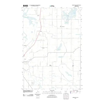
2010 Map of Jordan East
USGS Topo · Published 2010About this map
Sand Creek and its southern tributaries, including Porter Creek, carve through this Scott County landscape, defining the rural character of the region. The map reveals a transition from the wetland environments of Louisville Swamp near the Minnesota River in the northwest to the upland agricultural plateaus surrounding Saint Josephs. These waterways, punctuated by small glacial basins like Thole Lake and Sutton Lake, influenced the historical siting of early settlements and road networks.
Find a feature on this map
61 named features on this map. Tap any name to fly to it.
Don’t see what you’re looking for? This feature index may not catch every label — zoom into the map to look around manually.
Map Details
Editions of this 2010 Jordan East Map
This is the sole edition of this map. No revisions or reprints were ever made.
Other maps of this area

1896 · Minneapolis
USGS Topo · 1:62,500

1901 · Minneapolis
USGS Topo · 1:62,500

1905 · Minnetonka
USGS Topo · 1:62,500

1907 · Minnetonka
USGS Topo · 1:62,500

1953 · Saint Paul
USGS Topo · 1:250,000

1954 · Eden Prairie
USGS Topo · 1:24,000

1954 · Minneapolis
USGS Topo · 1:62,500

1957 · Prior Lake
USGS Topo · 1:62,500

1957 · New Prague
USGS Topo · 1:62,500

1958 · Victoria
USGS Topo · 1:24,000