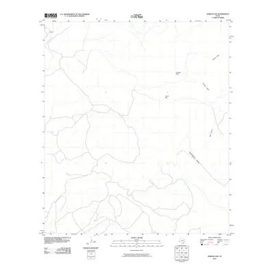
2010 Map of Jordan Gap
USGS Topo · Published 2010About this map
Perdiz sits in the northwest corner of this West Texas landscape, where the seasonal drainage of Alamito Creek carves through the high desert. The area is defined by a series of prominent elevated landforms, including Gemelo Mesa and Antelope Mesa, which rise above the surrounding flats. A network of unimproved roads and trails suggests a terrain primarily utilized for ranching and transit through the remote corridors of Presidio County. At the heart of the region lies Jordan Gap, a natural passage between the mesas. To the east and south, the topography descends into Paradise Valley and the steep-walled Beef Canyon, while the expansive Cartwright Mesa dominates the southeastern quadrant. This 2010 survey provides a clear look at the persistent land use and natural landmarks of the Trans-Pecos region, where naming conventions often reflect the local wildlife and cattle-grazing heritage.
Find a feature on this map
8 named features on this map. Tap any name to fly to it.
Don’t see what you’re looking for? This feature index may not catch every label — zoom into the map to look around manually.
Map Details
Editions of this 2010 Jordan Gap Map
This is the sole edition of this map. No revisions or reprints were ever made.
Other maps of this area

1895 · Marfa
USGS Topo · 1:125,000

1895 · Alpine
USGS Topo · 1:125,000

1896 · Shafter
USGS Topo · 1:125,000

1918 · Jordan Gap
USGS Topo · 1:62,500

1930 · Jordan Gap
USGS Topo · 1:62,500

1954 · Fort Stockton
USGS Topo · 1:250,000

1958 · Fort Stockton
USGS Topo · 1:250,000

1959 · Emory Peak
USGS Topo · 1:250,000

1959 · Presidio
USGS Topo · 1:250,000

1959 · Marfa
USGS Topo · 1:250,000