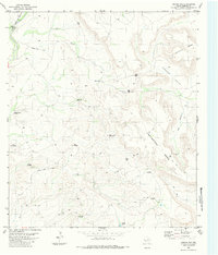
1983 Map of Jordan Gap
USGS Topo · Published 1984About this map
Jordan Gap serves as a prominent pass through the high desert terrain of Presidio County, marking a landscape defined by ranching infrastructure and remote transportation routes. The Atchison Topeka and Santa Fe railroad line skirts the northwestern corner of the area near Perdiz Creek, while the interior is accessible primarily via a network of jeep trails. Named windmills such as Lucky Windmill, High Lonesome Windmill, and Peach Tree Windmill suggest the critical importance of groundwater management for livestock across the broad plateaus of Mesa Gemelo and Cartwright Mesa. This 1980s-era documentation captures the spatial layout of the High Desert ranching economy, where features like an isolated landing strip and several water tanks highlight the logistical challenges of operating in Paradise Valley.
Find a feature on this map
22 named features on this map. Tap any name to fly to it.
Don’t see what you’re looking for? This feature index may not catch every label — zoom into the map to look around manually.
Map Details
Editions of this 1983 Jordan Gap Map
This is the sole edition of this map. No revisions or reprints were ever made.
Other maps of this area

1895 · Marfa
USGS Topo · 1:125,000

1895 · Alpine
USGS Topo · 1:125,000

1896 · Shafter
USGS Topo · 1:125,000

1918 · Jordan Gap
USGS Topo · 1:62,500

1930 · Jordan Gap
USGS Topo · 1:62,500

1954 · Fort Stockton
USGS Topo · 1:250,000

1958 · Fort Stockton
USGS Topo · 1:250,000

1959 · Emory Peak
USGS Topo · 1:250,000

1959 · Presidio
USGS Topo · 1:250,000

1959 · Marfa
USGS Topo · 1:250,000