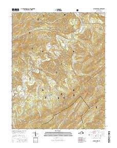
2016 Map of Jordan Mines
USGS Topo · Published 2016About this map
Jordan Mines and the surrounding mountain ridges define this corridor along the Alleghany, Botetourt, and Craig County borders. The map documents a landscape deeply shaped by extractive history and water management, visible in place names like Incline Hollow and the southeastern settlement of Lignite. The drainage systems of Potts Creek and Barbours Cr dictate the local geography, winding between prominent peaks such as Peters Mountain and the Rich Patch Mountains. Large portions of the terrain are protected within the George Washington National Forest and Jefferson National Forest, preserving unique geologic features like The Sinks and the natural upwelling at Boiling Spring. This survey provides a modern view of rural Virginia, where secondary roads like State Rte 617 connect small communities and high-elevation flats like Bowyer Flat and Kimberlin Flat.
Find a feature on this map
75 named features on this map. Tap any name to fly to it.
Don’t see what you’re looking for? This feature index may not catch every label — zoom into the map to look around manually.
Map Details
Editions of this 2016 Jordan Mines Map
This is the sole edition of this map. No revisions or reprints were ever made.
Other maps of this area

1887 · Lewisburg
USGS Topo · 1:125,000

1891 · Lewisburg
USGS Topo · 1:125,000

1894 · Natural Bridge
USGS Topo · 1:125,000

1913 · Eagle Rock
USGS Topo · 1:48,000

1915 · Eagle Rock
USGS Topo · 1:62,500

1921 · Callaghan
USGS Topo · 1:48,000

1923 · Callaghan
USGS Topo · 1:62,500

1945 · Clifton Forge
USGS Topo · 1:62,500
1945 · New Castle
USGS Topo · 1:62,500
1946 · Callaghan
USGS Topo · 1:62,500