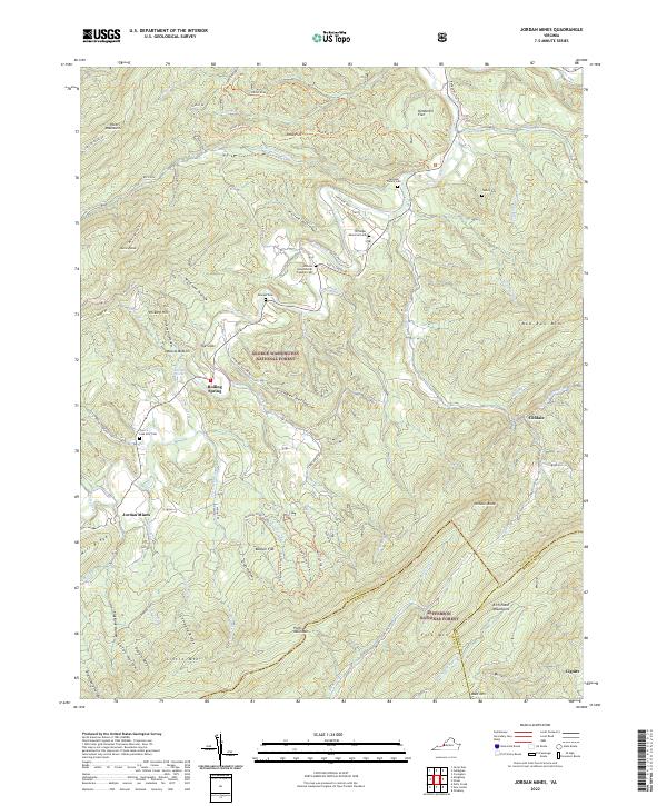
2022 Map of Jordan Mines
USGS Topo · Published 2022About this map
Potts Creek carves through the heart of this Alleghany County landscape, anchoring a series of small settlements and family holdings at the intersection of the George Washington National Forest and Jefferson National Forest. The map documents numerous small burial grounds that speak to the deep-rooted family history of the area, including the Caldwell Family Cem, the Persinger Memorial Cem, and the uniquely named Johnson Helmintoller Plymale Cem.
Find a feature on this map
76 named features on this map. Tap any name to fly to it.
Don’t see what you’re looking for? This feature index may not catch every label — zoom into the map to look around manually.
Map Details
Editions of this 2022 Jordan Mines Map
This is the sole edition of this map. No revisions or reprints were ever made.
Other maps of this area

1887 · Lewisburg
USGS Topo · 1:125,000

1891 · Lewisburg
USGS Topo · 1:125,000

1894 · Natural Bridge
USGS Topo · 1:125,000

1913 · Eagle Rock
USGS Topo · 1:48,000

1915 · Eagle Rock
USGS Topo · 1:62,500

1921 · Callaghan
USGS Topo · 1:48,000

1923 · Callaghan
USGS Topo · 1:62,500

1945 · Clifton Forge
USGS Topo · 1:62,500
1945 · New Castle
USGS Topo · 1:62,500
1946 · Callaghan
USGS Topo · 1:62,500