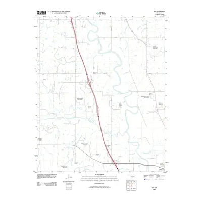
2009 Map of Joy
USGS Topo · Published 2009About this map
The Washita River meanders across this central Oklahoma landscape, defining the topography north of Davis. This area is characterized by a significant intersection of natural water systems and industrial development, where the river meets tributaries like Wildhorse Creek and Turkey Sandy Creek. The extraction economy of Murray County is evident through the widespread presence of petroleum resources, including the Hoover Oil Field, Northeast Butterly Oil Field, and South Butterly Oil Field. Local history is anchored by several burial grounds such as Wynnewood View Cemetery, Wheeler Flats Cemetery, and Oak Ridge Cemetery. A network of water management features is also prominent, with numerous flood control structures including Wildhorse Creek Site 1 Dam and Kickapoo Sandy Creek Site K5 Dam appearing across the drainage basins.
Find a feature on this map
48 named features on this map. Tap any name to fly to it.
Don’t see what you’re looking for? This feature index may not catch every label — zoom into the map to look around manually.
Map Details
Editions of this 2009 Joy Map
This is the sole edition of this map. No revisions or reprints were ever made.
Other maps of this area

1898 · Pauls Valley
USGS Topo · 1:125,000

1901 · Ardmore
USGS Topo · 1:125,000

1902 · Pauls Valley
USGS Topo · 1:125,000

1918 · Ardmore
USGS Topo · 1:125,000

1957 · Ardmore
USGS Topo · 1:250,000

1963 · Ardmore
USGS Topo · 1:250,000

1964 · Turner Falls
USGS Topo · 1:24,000

1965 · Pauls Valley NE
USGS Topo · 1:24,000

1965 · Pauls Valley
USGS Topo · 1:24,000

1965 · Davis
USGS Topo · 1:24,000