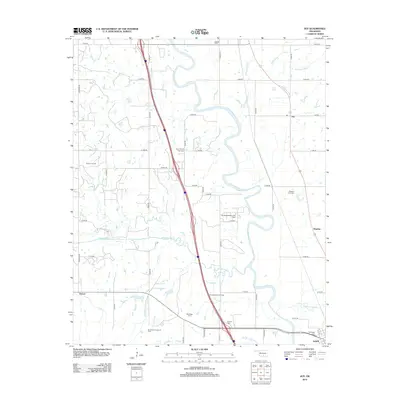
2012 Map of Joy
USGS Topo · Published 2012About this map
The Washita River meanders through this Murray County landscape, defining the character of the terrain alongside its primary tributaries: Wildhorse Cr and Kickapoo Sandy Cr. This 2012 survey illustrates a region where rural agriculture intersects with a significant energy economy, dominated by extensive extraction sites like the Hoover Oil Field and the South Butterly Oil Field. The industrial footprint of these fields is set against a backdrop of long-standing community landmarks, providing a clear view of how development has evolved around established settlements such as Joy, Washita, and Hoover.
Find a feature on this map
49 named features on this map. Tap any name to fly to it.
Don’t see what you’re looking for? This feature index may not catch every label — zoom into the map to look around manually.
Map Details
Editions of this 2012 Joy Map
This is the sole edition of this map. No revisions or reprints were ever made.
Other maps of this area

1898 · Pauls Valley
USGS Topo · 1:125,000

1901 · Ardmore
USGS Topo · 1:125,000

1902 · Pauls Valley
USGS Topo · 1:125,000

1918 · Ardmore
USGS Topo · 1:125,000

1957 · Ardmore
USGS Topo · 1:250,000

1963 · Ardmore
USGS Topo · 1:250,000

1964 · Turner Falls
USGS Topo · 1:24,000

1965 · Pauls Valley NE
USGS Topo · 1:24,000

1965 · Pauls Valley
USGS Topo · 1:24,000

1965 · Davis
USGS Topo · 1:24,000