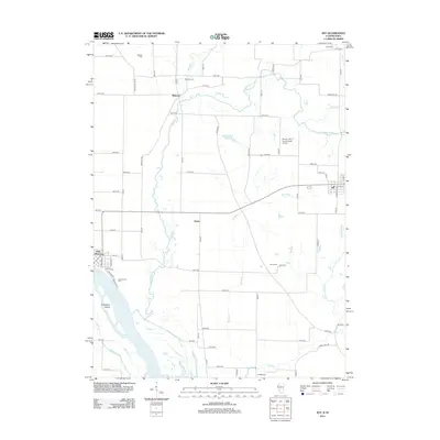
2012 Map of Joy
USGS Topo · Published 2012About this map
The Mississippi River and its intricate backwaters, including Ziegler Slough and Corsepius Island, define the western edge of this Mercer County landscape. Moving inland, the Edwards River and the Mad River cut through the agricultural tablelands, connecting small rural hubs. The riverfront community of New Boston stands as a primary settlement, while the village of Joy anchors the eastern side of the survey. Between them lie smaller localities such as Mannon and Arpee, representing the dispersed nature of the regional farming economy in the early 21st century.
Find a feature on this map
71 named features on this map. Tap any name to fly to it.
Don’t see what you’re looking for? This feature index may not catch every label — zoom into the map to look around manually.
Map Details
Editions of this 2012 Joy Map
This is the sole edition of this map. No revisions or reprints were ever made.
Other maps of this area

1916 · Edgington
USGS Topo · 1:62,500

1935 · Keithsburg
USGS Topo · 1:48,000

1938 · Edgington
USGS Topo · 1:62,500

1941 · Keithsburg
USGS Topo · 1:62,500

1946 · Wapello
USGS Topo · 1:62,500

1948 · Muscatine
USGS Topo · 1:62,500

1949 · Wapello
USGS Topo · 1:62,500

1953 · Toolesboro
USGS Topo · 1:24,000

1953 · Blanchard Island
USGS Topo · 1:24,000

1953 · Buffalo Prairie
USGS Topo · 1:24,000