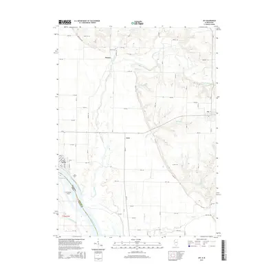
2015 Map of Joy
USGS Topo · Published 2015About this map
Mississippi River frontage and the low-lying terrain of Corsepius Island define the western edge of this Mercer County landscape. The settlement of New Boston occupies the riverbank, where the local street grid transitions into the expansive bottomlands near Ziegler Slough. Moving inland, the terrain rises toward the village of Joy and the smaller hamlets of Arpee and Mannon. This interior is heavily drained by the Edwards River and its tributaries, including Mad River and Camp Cr. Genealogists will find several rural burial sites throughout the township, such as Shields Cem and Mannon Cem in the north, and Davis Cem situated near the bluffs. The map captures the agricultural layout of the region, dominated by a strict grid of county roads like CR-10 and CR-9 that connect these dispersed communities and cemeteries.
Find a feature on this map
72 named features on this map. Tap any name to fly to it.
Don’t see what you’re looking for? This feature index may not catch every label — zoom into the map to look around manually.
Map Details
Editions of this 2015 Joy Map
This is the sole edition of this map. No revisions or reprints were ever made.
Other maps of this area

1916 · Edgington
USGS Topo · 1:62,500

1935 · Keithsburg
USGS Topo · 1:48,000

1938 · Edgington
USGS Topo · 1:62,500

1941 · Keithsburg
USGS Topo · 1:62,500

1946 · Wapello
USGS Topo · 1:62,500

1948 · Muscatine
USGS Topo · 1:62,500

1949 · Wapello
USGS Topo · 1:62,500

1953 · Toolesboro
USGS Topo · 1:24,000

1953 · Blanchard Island
USGS Topo · 1:24,000

1953 · Buffalo Prairie
USGS Topo · 1:24,000