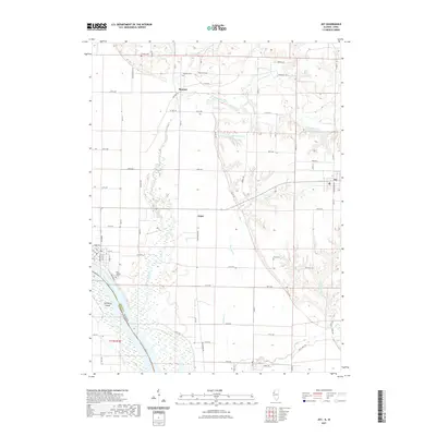
2021 Map of Joy
USGS Topo · Published 2021About this map
Mississippi River backwaters and the winding course of the Edwards River dominate this western Illinois landscape along the border with Iowa. The terrain transitions from the low-lying wetlands of Corsepius Island and Fuller Slough to the higher agricultural plains where the village of Joy and the settlement of Mannon are situated. This area reflects a long-established rural layout, with a dense network of country roads like Burger Bluff Rd and Sawmill Rd connecting disparate farmsteads. Local history is anchored by several burial grounds, including Mannon Cem and Shields Cem in the north, and Davis Cem near the Mad River in the south. The complex hydrology of the region is evident in the numerous small waterways such as Winters Cr, Big Chief Run, and Pope Cr that drain the fertile Mercer County soil.
Find a feature on this map
51 named features on this map. Tap any name to fly to it.
Don’t see what you’re looking for? This feature index may not catch every label — zoom into the map to look around manually.
Map Details
Editions of this 2021 Joy Map
This is the sole edition of this map. No revisions or reprints were ever made.
Other maps of this area

1916 · Edgington
USGS Topo · 1:62,500

1935 · Keithsburg
USGS Topo · 1:48,000

1938 · Edgington
USGS Topo · 1:62,500

1941 · Keithsburg
USGS Topo · 1:62,500

1946 · Wapello
USGS Topo · 1:62,500

1948 · Muscatine
USGS Topo · 1:62,500

1949 · Wapello
USGS Topo · 1:62,500

1953 · Toolesboro
USGS Topo · 1:24,000

1953 · Blanchard Island
USGS Topo · 1:24,000

1953 · Buffalo Prairie
USGS Topo · 1:24,000