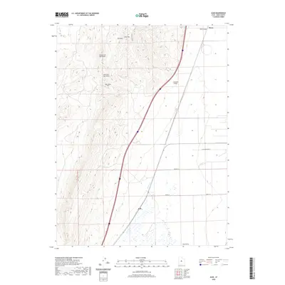
2020 Map of Juab
USGS Topo · Published 2020About this map
Juab and Sharp occupy the eastern flats of this high-desert corridor, where the land transitions from the West Hills into the broad expanse of Juab Valley. The geography is defined by significant elevation changes, ranging from the summit of Cedar Mtn to the drainage basins of Chicken Cr. This 2020 survey illustrates a modern transportation network cutting through the ancient terrain, following the natural path established by Lampson Canyon and the Sage Valley Pass. Local access is maintained through a series of named rural routes such as Slaughterhouse Ln, Crooked Ln, and Powell Ln, which anchor the sparse residential and agricultural footprint against the base of the mountains. The map provides a clear look at the hydraulic patterns in this arid region, tracing the Middle Fork Sage Valley and East Fork Sage Valley as they descend toward the valley floor.
Find a feature on this map
14 named features on this map. Tap any name to fly to it.
Don’t see what you’re looking for? This feature index may not catch every label — zoom into the map to look around manually.
Map Details
Editions of this 2020 Juab Map
This is the sole edition of this map. No revisions or reprints were ever made.
Other maps of this area

1885 · Manti
USGS Topo · 1:250,000

1885 · Sevier Desert
USGS Topo · 1:250,000

1895 · Manti
USGS Topo · 1:250,000

1951 · Nephi
USGS Topo · 1:62,500

1952 · Scipio North
USGS Topo · 1:62,500

1953 · Delta
USGS Topo · 1:250,000

1956 · Price
USGS Topo · 1:250,000

1958 · Delta
USGS Topo · 1:250,000

1960 · Price
USGS Topo · 1:250,000

1962 · Price
USGS Topo · 1:250,000