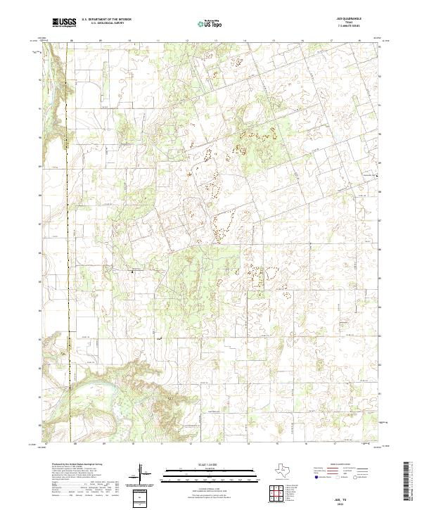
2022 Map of Jud
USGS Topo · Published 2022About this map
Jud stands at the center of this rural Haskell County landscape, serving as a focal point for a network of farm-to-market roads and county routes that define the region's agricultural layout. The terrain is marked by the winding course of the Double Mountain Fork Brazos River, which joins the main channel of the Brazos River near the western boundary between Stonewall Co and Haskell Co. This confluence area reveals the natural drainage patterns that have historically shaped settlement and land use in this part of West Texas.
Find a feature on this map
34 named features on this map. Tap any name to fly to it.
Don’t see what you’re looking for? This feature index may not catch every label — zoom into the map to look around manually.
Map Details
Editions of this 2022 Jud Map
This is the sole edition of this map. No revisions or reprints were ever made.
Other maps of this area

1925 · Aspermont 4-a
USGS Topo · 1:48,000

1925 · Haskell 3-b
USGS Topo · 1:48,000

1931 · Aspermont
USGS Topo · 1:62,500

1954 · Lubbock
USGS Topo · 1:250,000

1954 · Wichita Falls
USGS Topo · 1:250,000

1958 · Wichita Falls
USGS Topo · 1:250,000

1962 · Kiowa Peak
USGS Topo · 1:24,000

1965 · Jud
USGS Topo · 1:24,000
1966 · Pinkerton
USGS Topo · 1:24,000

1967 · Rochester
USGS Topo · 1:24,000