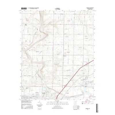
2017 Map of Judsonia
USGS Topo · Published 2017About this map
Searcy and Judsonia anchor the southern reaches of this landscape, where the meandering Little Red River defines the local topography and historical movement. The river’s course is marked by the notable Judsonia Bridge and surrounded by a network of drainage features like Deener Cr and Big Creek. To the north, the terrain transitions into a more rural character across Pine Hill and Backbone Ridge, where smaller settlements such as Holly Springs, Providence, and Plainview are situated.
Find a feature on this map
149 named features on this map. Tap any name to fly to it.
Don’t see what you’re looking for? This feature index may not catch every label — zoom into the map to look around manually.
Map Details
Editions of this 2017 Judsonia Map
This is the sole edition of this map. No revisions or reprints were ever made.
Other maps of this area

1932 · Kensett
USGS Topo · 1:62,500

1935 · Kensett
USGS Topo · 1:62,500

1935 · Bald Knob
USGS Topo · 1:62,500

1953 · Memphis
USGS Topo · 1:250,000

1956 · Memphis
USGS Topo · 1:250,000

1962 · Pangburn
USGS Topo · 1:24,000

1962 · Letona
USGS Topo · 1:24,000

1963 · Garner
USGS Topo · 1:24,000
1964 · Kensett
USGS Topo · 1:24,000
1964 · West Point
USGS Topo · 1:24,000