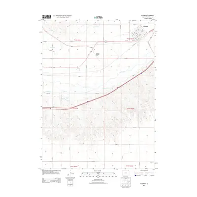
2013 Map of Julesburg
USGS Topo · Published 2013About this map
Julesburg sits at the northern edge of this landscape, its grid defined by streets like Cedar St, Ash St, and Elm St. The settlement's proximity to the S Platte River highlights a long history of water management in this part of Sedgwick County, where an intricate network of irrigation features includes the Highline Canal, Peterson Ditch, and Liddle Ditch. To the west, the Ovid Cem serves as a quiet landmark for genealogical research. The terrain south of the river is marked by the presence of Johnson Lake and Johnson Spring, contrasting with the more industrial activity near the Julesburg Municipal Airport. This modern survey documents the continued reliance on the river and its associated ditches, such as the Carlson Ditch and Reservation Ditch, which dominate the agricultural valley floor.
Find a feature on this map
42 named features on this map. Tap any name to fly to it.
Don’t see what you’re looking for? This feature index may not catch every label — zoom into the map to look around manually.
Map Details
Editions of this 2013 Julesburg Map
This is the sole edition of this map. No revisions or reprints were ever made.
Other maps of this area

1900 · Chappell
USGS Topo · 1:125,000

1952 · Julesburg SW
USGS Topo · 1:24,000

1952 · Julesburg SE
USGS Topo · 1:24,000

1953 · Ovid
USGS Topo · 1:24,000

1953 · Julesburg
USGS Topo · 1:24,000

1954 · Sterling
USGS Topo · 1:250,000

1954 · Scottsbluff
USGS Topo · 1:250,000

1958 · Scottsbluff
USGS Topo · 1:250,000

1958 · Sterling
USGS Topo · 1:250,000

1961 · Chappell
USGS Topo · 1:24,000