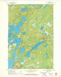
1970 Map of Julia Lake
USGS Topo · Published 1972About this map
The glacial waters of the Northwoods dominate this 1970 snapshot, where the Nicolet National Forest meets a complex chain of lakes in Oneida and Forest counties. Significant water bodies like Big Stone Lake, Big Fork Lake, and Julia Lake are interconnected by waterways such as The Thoroughfare, a pattern indicative of the region's recreational development. The infrastructure of the early 1970s is visible in the presence of the Three Lakes Municipal Airport and a prominent Golf Course, while the historic Military Road cuts through the northern timberland. The landscape is dotted with public access points, including numerous Boat Ramps and a Campground on Medicine Lake, reflecting the transition of this former logging frontier into a premier destination for sportsmen and summer residents.
Find a feature on this map
44 named features on this map. Tap any name to fly to it.
Don’t see what you’re looking for? This feature index may not catch every label — zoom into the map to look around manually.
Map Details
Editions of this 1970 Julia Lake Map
2 editions found
Other maps of this area

1928 · Three Lakes
USGS Topo · 1:48,000

1938 · Alvin
USGS Topo · 1:48,000

1938 · Three Lakes
USGS Topo · 1:48,000

1939 · Crandon
USGS Topo · 1:48,000

1940 · Monico
USGS Topo · 1:48,000

1941 · Crandon
USGS Topo · 1:48,000

1945 · Three Lakes
USGS Topo · 1:48,000

1946 · Alvin
USGS Topo · 1:48,000

1947 · Crandon
USGS Topo · 1:48,000

1950 · Monico
USGS Topo · 1:48,000