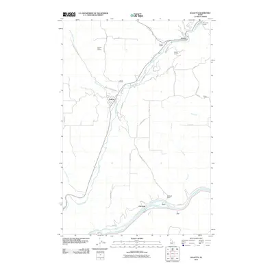
2010 Map of Juliaetta
USGS Topo · Published 2010About this map
Potlatch River and Clearwater River dictate the settlement patterns of this Latah County landscape, where deep canyons and steep grades separate the river valleys from the surrounding plateaus. The town of Juliaetta serves as a central hub along the riverbanks, while the neighboring settlement of Kendrick sits to the northeast at the confluence with Big Bear Creek. The area is characterized by its dramatic elevation changes, necessitating an extensive network of specialized roads like Sperry Grade, North Juliaetta Grade, and Old Bear Grade. For genealogists, the map is particularly valuable for its documentation of burial sites across the high ridges and valley floors, including American Ridge Cemetery, Juliaetta Cemetery, and Kendrick Cemetery. Near the southern boundary, the terrain levels out at the river bend near Cherrylane, where the Clearwater River broadens around Fir Island and against the steep face of Fir Bluff.
Find a feature on this map
40 named features on this map. Tap any name to fly to it.
Don’t see what you’re looking for? This feature index may not catch every label — zoom into the map to look around manually.
Map Details
Editions of this 2010 Juliaetta Map
This is the sole edition of this map. No revisions or reprints were ever made.
Other maps of this area

1955 · Pullman
USGS Topo · 1:250,000

1958 · Pullman
USGS Topo · 1:250,000

1958 · Lapwai
USGS Topo · 1:24,000

1958 · Lewiston Orchards
USGS Topo · 1:62,500

1958 · Culdesac
USGS Topo · 1:62,500

1960 · Troy
USGS Topo · 1:24,000

1961 · Kendrick
USGS Topo · 1:62,500

1961 · Moscow
USGS Topo · 1:62,500

1981 · Orofino
USGS Topo · 1:100,000

1981 · Potlatch
USGS Topo · 1:100,000