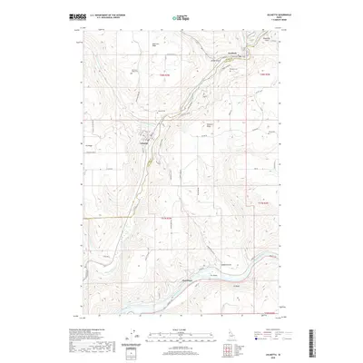
2020 Map of Juliaetta
USGS Topo · Published 2020About this map
Juliaetta and Kendrick anchor this topographic study, situated along the winding course of the Potlatch River near its confluence with the Clearwater River. The landscape is defined by dramatic elevation changes, moving from the river banks to the high plateau of American Ridge. Transport and connectivity are dictated by the deep drainages of Brady Gulch and Wauncher Gulch, with historical routes like Sperry Grade Rd and W Juliaetta Grade providing access between the valley floors and the upland ridges.
Find a feature on this map
66 named features on this map. Tap any name to fly to it.
Don’t see what you’re looking for? This feature index may not catch every label — zoom into the map to look around manually.
Map Details
Editions of this 2020 Juliaetta Map
This is the sole edition of this map. No revisions or reprints were ever made.
Other maps of this area

1955 · Pullman
USGS Topo · 1:250,000

1958 · Pullman
USGS Topo · 1:250,000

1958 · Lapwai
USGS Topo · 1:24,000

1958 · Lewiston Orchards
USGS Topo · 1:62,500

1958 · Culdesac
USGS Topo · 1:62,500

1960 · Troy
USGS Topo · 1:24,000

1961 · Kendrick
USGS Topo · 1:62,500

1961 · Moscow
USGS Topo · 1:62,500

1981 · Orofino
USGS Topo · 1:100,000

1981 · Potlatch
USGS Topo · 1:100,000