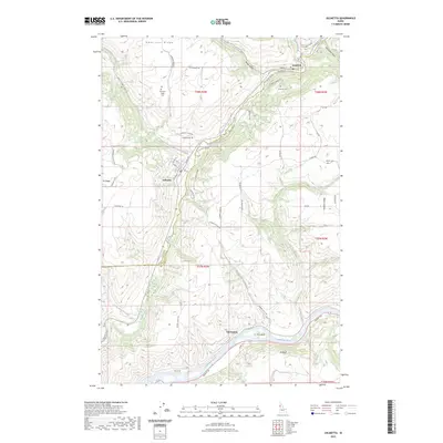
2023 Map of Juliaetta
USGS Topo · Published 2023About this map
The Potlatch River canyon cuts a deep path through Latah County, anchoring the communities of Kendrick and Juliaetta. This modern survey illustrates the steep relief between the river bottoms and the high plateau of American Ridge, where local history is preserved at the American Ridge Cem. The settlement pattern follows the drainage, with McGary Grade and Juliaetta Grade connecting the canyon floor to the agricultural lands above. To the south, the landscape opens as the Potlatch reaches its confluence with the Clearwater River at Cherrylane. Significant for genealogists, the map identifies several local burial grounds, including Kendrick Cem and Leland Cem, and details the winding road network from Hubbard Gulch Rd to Old Bear Grade that has defined travel in this territory for generations.
Find a feature on this map
66 named features on this map. Tap any name to fly to it.
Don’t see what you’re looking for? This feature index may not catch every label — zoom into the map to look around manually.
Map Details
Editions of this 2023 Juliaetta Map
This is the sole edition of this map. No revisions or reprints were ever made.
Other maps of this area

1955 · Pullman
USGS Topo · 1:250,000

1958 · Pullman
USGS Topo · 1:250,000

1958 · Lapwai
USGS Topo · 1:24,000

1958 · Lewiston Orchards
USGS Topo · 1:62,500

1958 · Culdesac
USGS Topo · 1:62,500

1960 · Troy
USGS Topo · 1:24,000

1961 · Kendrick
USGS Topo · 1:62,500

1961 · Moscow
USGS Topo · 1:62,500

1981 · Orofino
USGS Topo · 1:100,000

1981 · Potlatch
USGS Topo · 1:100,000