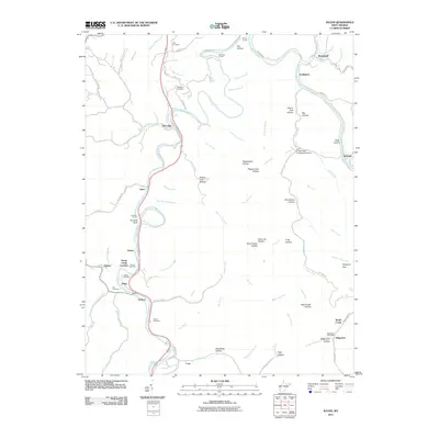
2011 Map of Julian
USGS Topo · Published 2011About this map
The Little Coal River and Big Coal River define the winding geography of this central West Virginia landscape, where small rail-side settlements and family landmarks populate the narrow valleys. Communities like Julian, McCorkle, and Brounland trace the paths of the rivers and the winding rail lines that cut through the terrain. Evidence of the region's industrial and transit history is visible in features like the Sprout Tunnel, Blue Tom Tunnel, and Pinnacle Tunnel, while the Fork Creek Public Hunting Area Dam marks a significant local landmark.
Find a feature on this map
102 named features on this map. Tap any name to fly to it.
Don’t see what you’re looking for? This feature index may not catch every label — zoom into the map to look around manually.
Map Details
Editions of this 2011 Julian Map
This is the sole edition of this map. No revisions or reprints were ever made.
Other maps of this area

1899 · Charleston
USGS Topo · 1:125,000

1909 · Charleston
USGS Topo · 1:62,500

1909 · Peytona
USGS Topo · 1:48,000

1909 · Saint Albans
USGS Topo · 1:62,500

1911 · Peytona
USGS Topo · 1:62,500

1911 · Madison
USGS Topo · 1:62,500

1929 · Madison
USGS Topo · 1:62,500

1929 · Peytona
USGS Topo · 1:62,500

1931 · Madison
USGS Topo · 1:62,500

1931 · Saint Albans
USGS Topo · 1:62,500