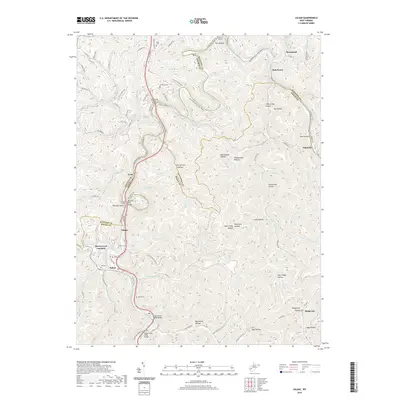
2019 Map of Julian
USGS Topo · Published 2019About this map
The Little Coal River carves a winding path through the borderlands of Kanawha, Lincoln, and Boone counties, serving as the central artery for a landscape defined by narrow hollows and high ridges. Significant infrastructure following the river's course includes several tunnels, such as Blue Tom Tunnel and Sprout Tunnel, which facilitate transport through the steep terrain. Small settlements like Julian, Emmons, and Brounland are concentrated along the riverbanks and rail line, reflecting the historical importance of the valley for movement and commerce. Local history is preserved in scattered family and community landmarks, including the Lory School and several burial sites such as Altman Cem and Moore Cem. The map illustrates the transition from high points like Priestly Ridge to deep drainages like Grindstone Hollow and Peter Cave Fork, showing the established pattern of rural Appalachian habitation where homes and roads cling to the limited level ground near the water.
Find a feature on this map
108 named features on this map. Tap any name to fly to it.
Don’t see what you’re looking for? This feature index may not catch every label — zoom into the map to look around manually.
Map Details
Editions of this 2019 Julian Map
This is the sole edition of this map. No revisions or reprints were ever made.
Other maps of this area

1899 · Charleston
USGS Topo · 1:125,000

1909 · Charleston
USGS Topo · 1:62,500

1909 · Peytona
USGS Topo · 1:48,000

1909 · Saint Albans
USGS Topo · 1:62,500

1911 · Peytona
USGS Topo · 1:62,500

1911 · Madison
USGS Topo · 1:62,500

1929 · Madison
USGS Topo · 1:62,500

1929 · Peytona
USGS Topo · 1:62,500

1931 · Madison
USGS Topo · 1:62,500

1931 · Saint Albans
USGS Topo · 1:62,500