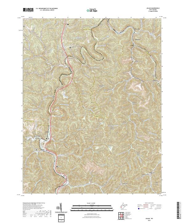
2023 Map of Julian
USGS Topo · Published 2023About this map
Little Coal River and Big Coal River define the intricate drainage patterns of this central West Virginia landscape, where the CSX railroad corridor winds through the valley floors. Small settlements like Julian, Emmons, and Hollyhurst are tucked into the narrow bottoms, following the natural contours of the terrain. For genealogists, the map identifies several hillside burial grounds including Pate Cem, Anderson Cem, and Moore Cem, which serve as quiet landmarks of local family heritage. The network of winding hollows, such as Rattlesnake Hollow and Grindstone Hollow, highlights the geographic isolation and complex topography that has long shaped the area's transportation and settlement history. Significant junctions like Horse Creek Junction and the small community at Ridgeview further illustrate the distribution of regional population centers along the river and rail arteries near the borders of Kanawha, Lincoln, and Boone counties.
Find a feature on this map
95 named features on this map. Tap any name to fly to it.
Don’t see what you’re looking for? This feature index may not catch every label — zoom into the map to look around manually.
Map Details
Editions of this 2023 Julian Map
This is the sole edition of this map. No revisions or reprints were ever made.
Other maps of this area

1899 · Charleston
USGS Topo · 1:125,000

1909 · Charleston
USGS Topo · 1:62,500

1909 · Peytona
USGS Topo · 1:48,000

1909 · Saint Albans
USGS Topo · 1:62,500

1911 · Peytona
USGS Topo · 1:62,500

1911 · Madison
USGS Topo · 1:62,500

1929 · Madison
USGS Topo · 1:62,500

1929 · Peytona
USGS Topo · 1:62,500

1931 · Madison
USGS Topo · 1:62,500

1931 · Saint Albans
USGS Topo · 1:62,500