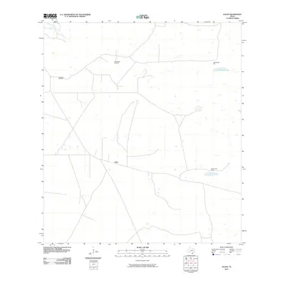
2010 Map of Julian
USGS Topo · Published 2010About this map
Julian and the nearby Chaparrosa Camp occupy a quiet stretch of south Texas ranch land in Kenedy County. The landscape is defined by its water management and sparse topography, featuring Candelaria Lake and the modest elevation of Candelaria Hill. The presence of name-bearing landmarks like the Alto Bonito Windmill and Tio Hilario Windmill highlights the vital role of groundwater infrastructure in this semi-arid environment. These named sites, often associated with historic ranching operations, provide anchor points in a terrain marked by a network of unimproved roads and small, scattered surface water features. This map reveals the persistence of traditional land use patterns, where isolated camps and windmills serve as the primary markers of human activity across the wide coastal plain.
Find a feature on this map
6 named features on this map. Tap any name to fly to it.
Don’t see what you’re looking for? This feature index may not catch every label — zoom into the map to look around manually.
Map Details
Editions of this 2010 Julian Map
This is the sole edition of this map. No revisions or reprints were ever made.
Other maps of this area

1922 · La Sal Vieja
USGS Topo · 1:62,500

1923 · Armstrong
USGS Topo · 1:62,500

1939 · Linn
USGS Topo · 1:62,500

1949 · Mc Allen
USGS Topo · 1:250,000

1953 · Brownsville
USGS Topo · 1:250,000

1954 · McAllen
USGS Topo · 1:250,000

1956 · Pita Camp
USGS Topo · 1:24,000
1956 · Armstrong
USGS Topo · 1:24,000

1956 · Julian
USGS Topo · 1:24,000

1956 · Rudolph
USGS Topo · 1:24,000