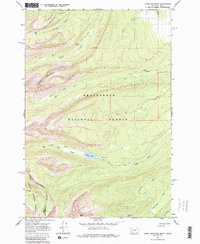
1966 Map of Jumbo Mountain
USGS Topo · Published 1987About this map
The Continental Divide winds through this high-altitude landscape along the border of Montana and Idaho, marking the boundary between the Beaverhead National Forest and the Salmon National Forest. This 1960s survey documents a terrain dominated by significant peaks like Jumbo Mountain and Squaw Mtn, where movement was dictated by a network of Pack Trails and Jeep Trails.
Find a feature on this map
26 named features on this map. Tap any name to fly to it.
Don’t see what you’re looking for? This feature index may not catch every label — zoom into the map to look around manually.
Map Details
Editions of this 1966 Jumbo Mountain Map
3 editions found
Other maps of this area

1955 · Dillon
USGS Topo · 1:250,000

1957 · Dillon
USGS Topo · 1:250,000

1958 · Dillon
USGS Topo · 1:250,000

1962 · Dillon
USGS Topo · 1:250,000

1965 · Dillon
USGS Topo · 1:250,000

1966 · Badger Spring Gulch
USGS Topo · 1:24,000

1966 · Shewag Lake
USGS Topo · 1:24,000

1966 · Miner Lake
USGS Topo · 1:24,000

1966 · Jumbo Mountain
USGS Topo · 1:24,000

1966 · Big Hole Pass
USGS Topo · 1:24,000