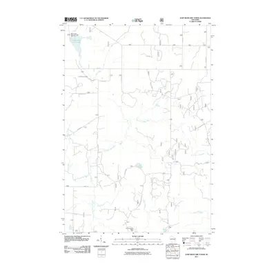
2011 Map of Jump River Fire Tower
USGS Topo · Published 2011About this map
The Jump River Fire Tower stands as a primary landmark in this Taylor County landscape, overlooking a complex network of waterways and managed timberlands. This 2011 survey documents a region defined by its hydrography, where the North Fork Yellow River and South Fork Yellow River converge amidst a system of creeks and flowages. Infrastructure for water management and wildlife is evident through features like the Steve Creek Water Fowl 2WP 1669 Dam and the Dennis Gisvold E4894 Dam near Pickerel Lake. The road network, including Hannibal Rd and Heldstab Rd, reflects a rural grid punctuated by specialized access routes like Forest Rd 570, likely serving the forestry or recreational interests surrounding Lost Lake and the various branches of Steve Creek.
Find a feature on this map
23 named features on this map. Tap any name to fly to it.
Don’t see what you’re looking for? This feature index may not catch every label — zoom into the map to look around manually.
Map Details
Editions of this 2011 Jump River Fire Tower Map
This is the sole edition of this map. No revisions or reprints were ever made.
Other maps of this area

1944 · Ogema
USGS Topo · 1:48,000

1945 · Black River
USGS Topo · 1:48,000

1947 · Ogema
USGS Topo · 1:48,000

1949 · Ogema
USGS Topo · 1:48,000

1949 · Jump River Fire Tower
USGS Topo · 1:48,000

1951 · Lublin
USGS Topo · 1:48,000

1951 · Medford
USGS Topo · 1:48,000

1953 · Rice Lake
USGS Topo · 1:250,000

1959 · Rice Lake
USGS Topo · 1:250,000

1969 · Perkinstown
USGS Topo · 1:24,000