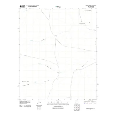
2010 Map of Jumping Spring
USGS Topo · Published 2010About this map
Jumping Spring and its surrounding desert draws define this arid landscape in Eddy County at the start of the 21st century. The map centers on the Dillahunty Ranch, where water sources like Butcher Spring and Little Windmill were essential for sustaining livestock and human habitation. This area is etched by seasonal watercourses and drainage systems such as Cottonwood Draw, Ben Slaughter Draw, and Hay Hollow, which lead toward the Black River in the northwest.
Find a feature on this map
24 named features on this map. Tap any name to fly to it.
Don’t see what you’re looking for? This feature index may not catch every label — zoom into the map to look around manually.
Map Details
Editions of this 2010 Jumping Spring Map
This is the sole edition of this map. No revisions or reprints were ever made.
Other maps of this area

1945 · Carlsbad Caverns East
USGS Topo · 1:62,500

1945 · Malaga
USGS Topo · 1:62,500

1946 · Malaga
USGS Topo · 1:62,500

1947 · Carlsbad Caverns East
USGS Topo · 1:62,500

1954 · Carlsbad
USGS Topo · 1:250,000

1954 · Van Horn
USGS Topo · 1:250,000

1958 · Van Horn
USGS Topo · 1:250,000

1958 · Carlsbad
USGS Topo · 1:250,000

1973 · Owl Hills
USGS Topo · 1:24,000
1973 · Outlaw Spring
USGS Topo · 1:24,000