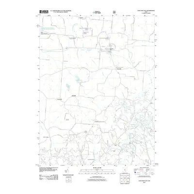
2011 Map of Junction City
USGS Topo · Published 2011About this map
Junction City sits at the heart of this landscape where several watercourses and historic transportation routes converge. The area is marked by a deep concentration of nineteenth-century religious and burial sites, including the New Lebanon Evangelical Lutheran Cemetery and the Friendship Methodist Episcopal Cemetery. A notable industrial and institutional landmark is the Ohio State Penitentiary Junction City Branch, reflecting the region's historical role in state infrastructure.
Find a feature on this map
83 named features on this map. Tap any name to fly to it.
Don’t see what you’re looking for? This feature index may not catch every label — zoom into the map to look around manually.
Map Details
Editions of this 2011 Junction City Map
This is the sole edition of this map. No revisions or reprints were ever made.
Other maps of this area

1907 · Logan
USGS Topo · 1:62,500

1909 · Thornville
USGS Topo · 1:62,500

1909 · Logan
USGS Topo · 1:62,500

1910 · Zanesville
USGS Topo · 1:62,500

1911 · New Lexington
USGS Topo · 1:62,500

1947 · Columbus
USGS Topo · 1:250,000

1961 · Columbus
USGS Topo · 1:250,000

1961 · Rushville
USGS Topo · 1:24,000

1961 · New Lexington
USGS Topo · 1:24,000
1961 · New Straitsville
USGS Topo · 1:24,000