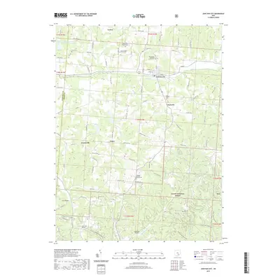
2019 Map of Junction City
USGS Topo · Published 2019About this map
Junction City serves as the focal point of this 2019 survey, situated at the confluence of Rush Creek and its various tributaries. The landscape is defined by the sharp transition from the settled valleys of Clarksville and Crossenville into the densely wooded terrain of the Wayne National Forest to the south. This area is particularly rich for genealogical research, documenting numerous small religious burial grounds such as the Friendship Methodist Episcopal Cem, New Lebanon Evangelical Lutheran Cem, and the Mount Zion United Brethren In Christ Cem. Local industry and geography are reflected in names like Lime Kiln Hollow and Coalbrook Hollow, while water management is evidenced by the Rush Cr Conservation District Structure Reservoir. The map captures the enduring rural character of Perry County, where small hamlets like Salem and Dixie remain connected by an intricate network of township and county roads.
Find a feature on this map
96 named features on this map. Tap any name to fly to it.
Don’t see what you’re looking for? This feature index may not catch every label — zoom into the map to look around manually.
Map Details
Editions of this 2019 Junction City Map
This is the sole edition of this map. No revisions or reprints were ever made.
Other maps of this area

1907 · Logan
USGS Topo · 1:62,500

1909 · Thornville
USGS Topo · 1:62,500

1909 · Logan
USGS Topo · 1:62,500

1910 · Zanesville
USGS Topo · 1:62,500

1911 · New Lexington
USGS Topo · 1:62,500

1947 · Columbus
USGS Topo · 1:250,000

1961 · Columbus
USGS Topo · 1:250,000

1961 · Rushville
USGS Topo · 1:24,000

1961 · New Lexington
USGS Topo · 1:24,000
1961 · New Straitsville
USGS Topo · 1:24,000