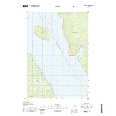
2021 Map of Juneau A-1 SE
USGS Topo · Published 2021About this map
Stephens Passage dominates this coastal survey, serving as the primary waterway between the mainland and the island topography of Southeast Alaska. The landscape is defined by the steep elevation of the Coast Mountains, where peaks like Butler Peak and Taku Mtn rise sharply from the shoreline. This 2021 edition illustrates the heavy integration of the Tongass National Forest across the region, showing the complex interaction of tidal waters and protected forest lands.
Find a feature on this map
13 named features on this map. Tap any name to fly to it.
Don’t see what you’re looking for? This feature index may not catch every label — zoom into the map to look around manually.
Map Details
Editions of this 2021 Juneau A-1 SE Map
This is the sole edition of this map. No revisions or reprints were ever made.
Other maps of this area

1948 · Sitka D-1
USGS Topo · 1:63,360

1948 · Sumdum D-6
USGS Topo · 1:63,360

1951 · Juneau
USGS Topo · 1:250,000

1951 · Taku River A-6
USGS Topo · 1:63,360

1951 · Sitka
USGS Topo · 1:250,000

1951 · Juneau A-1
USGS Topo · 1:63,360

1951 · Sitka D-1
USGS Topo · 1:63,360

1951 · Sumdum D-6
USGS Topo · 1:63,360

1952 · Sumdum
USGS Topo · 1:250,000

1952 · Sitka
USGS Topo · 1:250,000