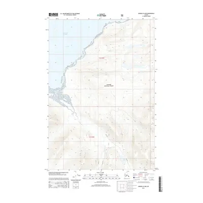
2015 Map of Juneau A-6 NW
USGS Topo · Published 2015About this map
Tongass National Forest dominates this coastal Alaska landscape, where the tidal waters of the Gulf of Alaska meet the intricate shoreline of Icy Strait. The terrain is defined by dramatic elevation changes rising from the coastal flats, carved by the courses of the Mud Bay River and the Neka River. In the southern portion of the map, the landscape transitions toward Otter Lake, while the mysterious Neka Mud area suggests the soft, silty nature of the river delta and estuarine environment. This survey captures a region primarily managed for its timber and natural resources, as indicated by the presence of U.S. Forest Service roads that provide the only terrestrial access through these dense coastal woods and mountainous slopes.
Find a feature on this map
9 named features on this map. Tap any name to fly to it.
Don’t see what you’re looking for? This feature index may not catch every label — zoom into the map to look around manually.
Map Details
Editions of this 2015 Juneau A-6 NW Map
This is the sole edition of this map. No revisions or reprints were ever made.
Other maps of this area

1948 · Juneau B-6
USGS Topo · 1:63,360

1948 · Mount Fairweather B-1
USGS Topo · 1:63,360

1948 · Mount Fairweather A-1
USGS Topo · 1:63,360

1951 · Juneau
USGS Topo · 1:250,000

1951 · Juneau A-6
USGS Topo · 1:63,360

1951 · Mt Fairweather
USGS Topo · 1:250,000

1954 · Mount Fairweather A-1
USGS Topo · 1:63,360

1961 · Mt Fairweather
USGS Topo · 1:250,000

1962 · Juneau
USGS Topo · 1:250,000
2000 · Juneau A-6
USGS Topo · 1:63,360