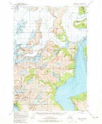
1948 Map of Juneau B-1
USGS Topo · Published 1972About this map
Glacial ice and industrial infrastructure define this landscape within the Tongass National Forest just east of Juneau. The map illustrates the massive reach of the Norris Glacier and Taku Glacier, along with the Dead Branch and Lemon Creek Glacier. These ice fields tower over Taku Inlet and the Gastineau Channel, where the shoreline is marked by the settlement of Thane and specialized industrial sites.
Find a feature on this map
56 named features on this map. Tap any name to fly to it.
Don’t see what you’re looking for? This feature index may not catch every label — zoom into the map to look around manually.
Map Details
Editions of this 1948 Juneau B-1 Map
2 editions found
Other maps of this area

1947 · Juneau B-2
USGS Topo · 1:63,360

1948 · Juneau B-1
USGS Topo · 1:63,360

1949 · Juneau B-2
USGS Topo · 1:62,500

1951 · Juneau
USGS Topo · 1:250,000

1951 · Taku River B-6
USGS Topo · 1:63,360

1951 · Taku River A-6
USGS Topo · 1:63,360

1951 · Juneau A-2
USGS Topo · 1:63,360

1951 · Juneau A-1
USGS Topo · 1:63,360

1952 · Juneau B-1
USGS Topo · 1:63,360

1953 · Taku River
USGS Topo · 1:250,000