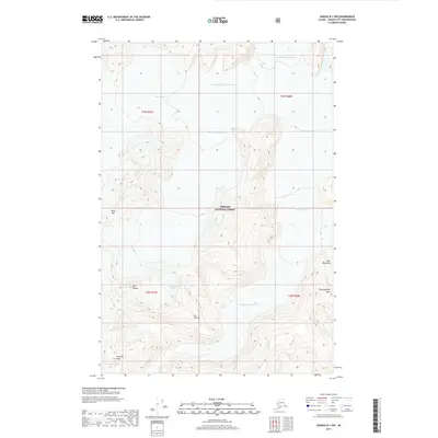
2017 Map of Juneau B-1 NW
USGS Topo · Published 2017About this map
Norris Glacier dominates this high-altitude landscape within the Tongass National Forest, displaying a complex network of glacial movement and alpine features. The map illustrates the various tributaries that feed this massive ice system, including the North Branch, Middle Branch, and Death Valley Branch. These frozen rivers wind through the high peaks of the Coast Mountains, creating a rugged vertical environment marked by significant landmarks like Scorpion Peak and the prominent Sol Thumb.
Find a feature on this map
18 named features on this map. Tap any name to fly to it.
Don’t see what you’re looking for? This feature index may not catch every label — zoom into the map to look around manually.
Map Details
Editions of this 2017 Juneau B-1 NW Map
This is the sole edition of this map. No revisions or reprints were ever made.
Other maps of this area

1947 · Juneau B-2
USGS Topo · 1:63,360

1948 · Juneau B-1
USGS Topo · 1:63,360

1949 · Juneau B-2
USGS Topo · 1:62,500

1951 · Juneau
USGS Topo · 1:250,000

1952 · Juneau B-1
USGS Topo · 1:63,360

1960 · Juneau C-2
USGS Topo · 1:63,360

1960 · Juneau C-1
USGS Topo · 1:63,360

1962 · Juneau B-2
USGS Topo · 1:63,360

1962 · Juneau
USGS Topo · 1:250,000
1986 · Juneau B-1 SW
USGS Topo · 1:25,000