
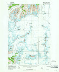
1960 Map of Juneau C-2
USGS Topo · Published 1965About this map
Taku Glacier and the surrounding icefields dominate this mid-century topographic record of the coastal mountains near Juneau. The survey captures a landscape defined by massive ice movements, including the Mendenhall Glacier and the Northwest Branch, illustrating the complex drainage patterns of the Tongass National Forest before more modern glacial retreat.
Find a feature on this map
37 named features on this map. Tap any name to fly to it.
Don’t see what you’re looking for? This feature index may not catch every label — zoom into the map to look around manually.
Map Details
Editions of this 1960 Juneau C-2 Map
2 editions found
Other maps of this area

1947 · Juneau B-3
USGS Topo · 1:63,360

1947 · Juneau B-2
USGS Topo · 1:63,360

1948 · Juneau D-3
USGS Topo · 1:63,360

1948 · Juneau B-1
USGS Topo · 1:63,360

1949 · Juneau B-3
USGS Topo · 1:62,500

1949 · Juneau B-2
USGS Topo · 1:62,500

1949 · Juneau D-3
USGS Topo · 1:63,360

1951 · Juneau
USGS Topo · 1:250,000

1951 · Juneau C-3
USGS Topo · 1:63,360

1952 · Juneau B-1
USGS Topo · 1:63,360