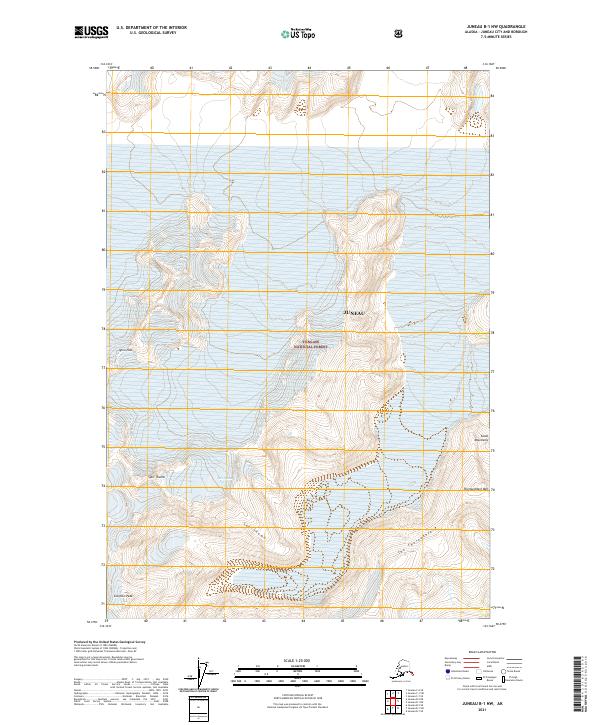
2021 Map of Juneau B-1 NW
USGS Topo · Published 2021About this map
Tongass National Forest dominates this section of the Alskan wilderness within the Juneau city and borough limits. The landscape is defined by the high peaks of the Coast Mountains, where ice and rock formations create a complex vertical environment. Distinctive landmarks such as Split Thumb, Sol Thumb, and Scorpion Peak serve as primary navigational points in an area largely devoid of human infrastructure. The presence of The Thoroughfare and Thoroughfare Mtn suggests established corridors through the high country, while Igloo Pass provides a transition point through the mountain range. This 2021 edition reflects the modern state of these glaciated landforms, offering a precise view of the topography that continues to shape the character of the region near the state capital.
Find a feature on this map
13 named features on this map. Tap any name to fly to it.
Don’t see what you’re looking for? This feature index may not catch every label — zoom into the map to look around manually.
Map Details
Editions of this 2021 Juneau B-1 NW Map
This is the sole edition of this map. No revisions or reprints were ever made.
Other maps of this area

1947 · Juneau B-2
USGS Topo · 1:63,360

1948 · Juneau B-1
USGS Topo · 1:63,360

1949 · Juneau B-2
USGS Topo · 1:62,500

1951 · Juneau
USGS Topo · 1:250,000

1952 · Juneau B-1
USGS Topo · 1:63,360

1960 · Juneau C-2
USGS Topo · 1:63,360

1960 · Juneau C-1
USGS Topo · 1:63,360

1962 · Juneau B-2
USGS Topo · 1:63,360

1962 · Juneau
USGS Topo · 1:250,000
1986 · Juneau B-1 SW
USGS Topo · 1:25,000