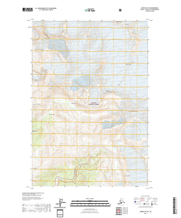
2021 Map of Juneau B-2 NE
USGS Topo · Published 2021About this map
Tongass National Forest encompasses the high alpine environment of the Coast Mountains on this 2021 topographic record. The landscape is defined by dramatic elevation changes, moving from the glacial features of the Upper Basin and Middle Basin toward the prominent Heintzleman Ridge. Several major drainages, including Lemon Creek and Nugget Cr, cut through the terrain, illustrating the region's complex hydrological patterns. Named peaks and spires, such as Amherst Peak, Spencer Peak, and the distinctive North Nugget Spire, serve as key navigational landmarks within this wilderness area. The map also captures the geographic transition toward Tlaxsatanjin and the sharp relief of Ptarmigan Ridge, providing a precise look at the modern state of this glacier-carved territory.
Find a feature on this map
30 named features on this map. Tap any name to fly to it.
Don’t see what you’re looking for? This feature index may not catch every label — zoom into the map to look around manually.
Map Details
Editions of this 2021 Juneau B-2 NE Map
This is the sole edition of this map. No revisions or reprints were ever made.
Other maps of this area

1947 · Juneau B-2
USGS Topo · 1:63,360

1948 · Juneau B-1
USGS Topo · 1:63,360

1949 · Juneau B-2
USGS Topo · 1:62,500

1951 · Juneau
USGS Topo · 1:250,000

1952 · Juneau B-1
USGS Topo · 1:63,360

1960 · Juneau C-2
USGS Topo · 1:63,360

1960 · Juneau C-1
USGS Topo · 1:63,360

1962 · Juneau B-2
USGS Topo · 1:63,360

1962 · Juneau
USGS Topo · 1:250,000
1986 · Juneau B-1 SW
USGS Topo · 1:25,000