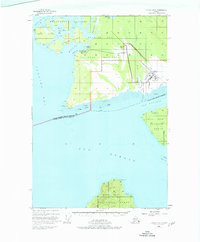
1948 Map of Juneau B-6
USGS Topo · Published 1977About this map
Gustavus stands as the primary outpost on the southern edge of the Glacier Bay National Monument in this mid-century survey. Located along the Salmon River, the settlement is supported by the Gustavus Airfield and a nearby Seaplane Base at Bartlett Cove. This geography highlights the critical role of aviation and maritime transport in Southeast Alaska before more modern infrastructure arrived. The coastal environment is defined by significant landmarks such as Pt Gustavus and the sweeping waters of Icy Passage and Icy Strait.
Find a feature on this map
30 named features on this map. Tap any name to fly to it.
Don’t see what you’re looking for? This feature index may not catch every label — zoom into the map to look around manually.
Map Details
Editions of this 1948 Juneau B-6 Map
4 editions found
Other maps of this area

1948 · Juneau C-5
USGS Topo · 1:63,360

1948 · Juneau B-6
USGS Topo · 1:63,360

1948 · Juneau C-6
USGS Topo · 1:63,360

1948 · Juneau B-5
USGS Topo · 1:63,360

1948 · Mount Fairweather B-1
USGS Topo · 1:63,360

1948 · Mount Fairweather A-1
USGS Topo · 1:63,360

1948 · Mount Fairweather C-1
USGS Topo · 1:63,360

1949 · Mount Fairweather C-1
USGS Topo · 1:63,360

1950 · Juneau C-6
USGS Topo · 1:63,360

1950 · Juneau B-5
USGS Topo · 1:63,360