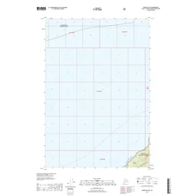
2017 Map of Juneau B-6 SW
USGS Topo · Published 2017About this map
Icy Strait dominates this coastal landscape, serving as a critical maritime passage within the Alexander Archipelago. To the north, the protected waters reach the southern boundary of Glacier Bay National Park, while the rugged shoreline of Chichagof Island rises in the southeast. This portion of the island is situated within the Tongass National Forest, illustrating the immense scale of federal land management in Southeast Alaska. The lack of settlements or roads emphasizes the maritime character of the region, where the strait is the primary corridor for transit between the Pacific and the internal waterways of the Panhandle. The map provides a clear look at the intersection of these two massive protected wilderness areas as they were defined in 2017.
Find a feature on this map
10 named features on this map. Tap any name to fly to it.
Don’t see what you’re looking for? This feature index may not catch every label — zoom into the map to look around manually.
Map Details
Editions of this 2017 Juneau B-6 SW Map
This is the sole edition of this map. No revisions or reprints were ever made.
Other maps of this area

1948 · Juneau B-6
USGS Topo · 1:63,360

1948 · Mount Fairweather B-1
USGS Topo · 1:63,360

1948 · Mount Fairweather A-1
USGS Topo · 1:63,360

1951 · Juneau
USGS Topo · 1:250,000

1951 · Juneau A-6
USGS Topo · 1:63,360

1951 · Mt Fairweather
USGS Topo · 1:250,000

1954 · Mount Fairweather A-1
USGS Topo · 1:63,360

1961 · Mt Fairweather
USGS Topo · 1:250,000

1962 · Juneau
USGS Topo · 1:250,000
2000 · Juneau A-6
USGS Topo · 1:63,360