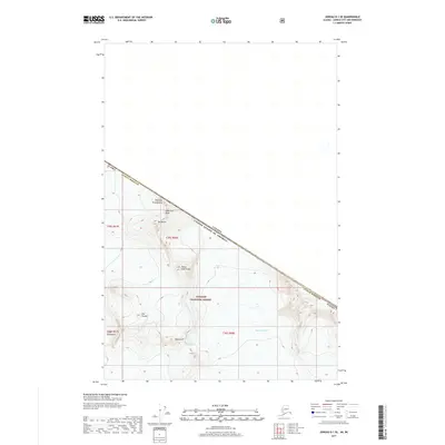
2017 Map of Juneau D-1 SE
USGS Topo · Published 2017About this map
Demorest Glacier and Hole-in-the-Wall Glacier dominate this high-altitude landscape where the international border separates the Juneau Borough from British Columbia. The terrain is defined by the sharp peaks of the Coast Mountains, including named summits like Mt Moore and The Citadel. Within the protected boundaries of the Tongass National Forest, the topography reveal several distinctive geological features such as Picket Gate Crags and the Governors Ridge. This 2017 survey illustrates the remote wilderness character of the frontier, documenting the frozen expanses and ridges that form the natural and political divide between the United States and Canada.
Find a feature on this map
17 named features on this map. Tap any name to fly to it.
Don’t see what you’re looking for? This feature index may not catch every label — zoom into the map to look around manually.
Map Details
Editions of this 2017 Juneau D-1 SE Map
This is the sole edition of this map. No revisions or reprints were ever made.
Other maps of this area

1951 · Juneau
USGS Topo · 1:250,000

1953 · Taku River
USGS Topo · 1:250,000

1960 · Taku River C-6
USGS Topo · 1:63,360

1960 · Juneau D-1
USGS Topo · 1:63,360

1960 · Juneau C-1
USGS Topo · 1:63,360

1960 · Taku River
USGS Topo · 1:250,000

1962 · Juneau
USGS Topo · 1:250,000

1995 · Taku River C-6
USGS Topo · 1:63,360
2017 · Juneau D-1 SW
USGS Topo · 1:25,000
2017 · Juneau C-1 NE
USGS Topo · 1:25,000