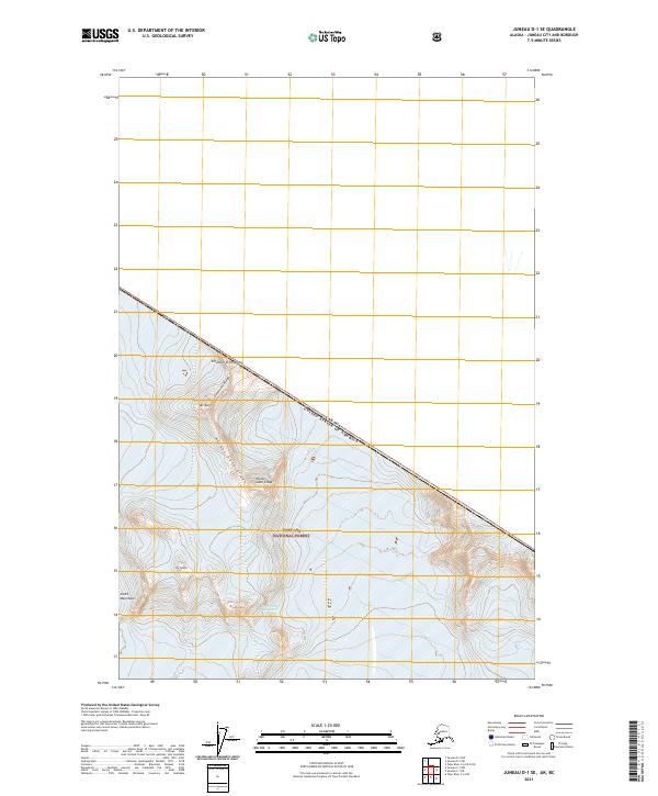
2021 Map of Juneau D-1 SE
USGS Topo · Published 2021About this map
The high peaks of the Coast Mountains define this international boundary region where the Tongass National Forest meets the border of British Columbia. This survey centers on a dramatic glacial landscape, most notably the Hole in the Wall Glacier, which is flanked by the sharp rises of Dipyramid and The Citadel. The terrain is characterized by steep ridges and named peaks that serve as key navigational markers in this remote section of the Alaska Panhandle. To the north, Governors Ridge and Mt Moore lead toward the Canada-United States border, which follows the high divide across Elephant Promontory. The map provides an exacting record of the natural landforms and ice features as they existed in the early twenty-first century, including the distinct formations of the Picket Gate Crags.
Find a feature on this map
14 named features on this map. Tap any name to fly to it.
Don’t see what you’re looking for? This feature index may not catch every label — zoom into the map to look around manually.
Map Details
Editions of this 2021 Juneau D-1 SE Map
This is the sole edition of this map. No revisions or reprints were ever made.
Other maps of this area

1951 · Juneau
USGS Topo · 1:250,000

1953 · Taku River
USGS Topo · 1:250,000

1960 · Taku River C-6
USGS Topo · 1:63,360

1960 · Juneau D-1
USGS Topo · 1:63,360

1960 · Juneau C-1
USGS Topo · 1:63,360

1960 · Taku River
USGS Topo · 1:250,000

1962 · Juneau
USGS Topo · 1:250,000

1995 · Taku River C-6
USGS Topo · 1:63,360
2017 · Juneau D-1 SW
USGS Topo · 1:25,000
2017 · Juneau D-1 SE
USGS Topo · 1:25,000