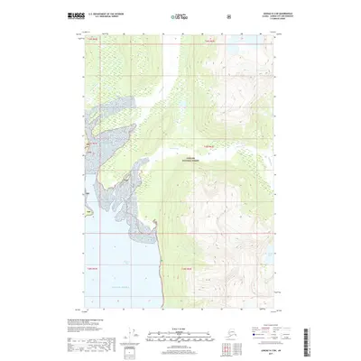
2017 Map of Juneau D-3 SW
USGS Topo · Published 2017About this map
Berners Bay serves as the central coastal feature of this wilderness area, where several glacial river systems converge into the Gulf of Alaska. The landscape is dominated by the heavily timbered and mountainous reaches of the Tongass National Forest, showing the complex drainage patterns of the Berners River, Lace River, and Antler River. This 2017 survey illustrates the intricate relationship between the coastal inlets and the high-elevation terrain typical of Southeast Alaska. These waterways provide a detailed study of the alluvial plains and delta formations where the river mouths meet the bay. Farther inland, the terrain rises sharply toward the east, containing the secluded Antler Lake and the winding course of the Gilkey River. The map provides essential data for understanding the hydrography and topographical boundaries of this protected forest region.
Find a feature on this map
17 named features on this map. Tap any name to fly to it.
Don’t see what you’re looking for? This feature index may not catch every label — zoom into the map to look around manually.
Map Details
Editions of this 2017 Juneau D-3 SW Map
This is the sole edition of this map. No revisions or reprints were ever made.
Other maps of this area

1948 · Juneau C-4
USGS Topo · 1:63,360

1948 · Juneau D-3
USGS Topo · 1:63,360

1949 · Juneau D-4
USGS Topo · 1:63,360

1949 · Juneau C-4
USGS Topo · 1:63,360

1949 · Juneau D-3
USGS Topo · 1:63,360

1951 · Juneau
USGS Topo · 1:250,000

1951 · Juneau D-4
USGS Topo · 1:63,360

1951 · Juneau C-3
USGS Topo · 1:63,360

1952 · Juneau C-3
USGS Topo · 1:63,360

1953 · Juneau D-3
USGS Topo · 1:63,360