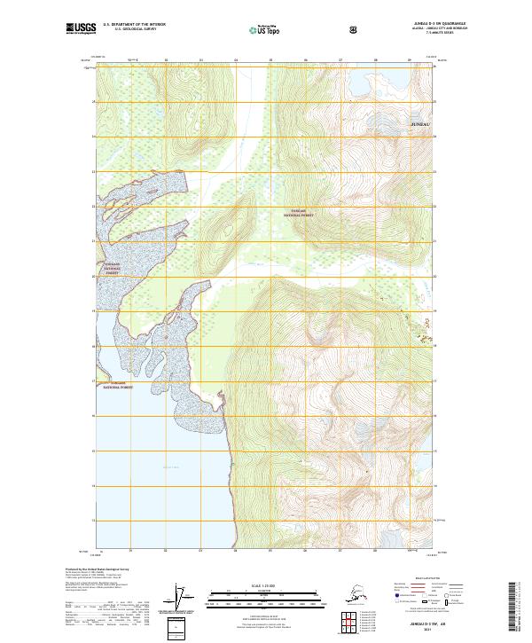
2021 Map of Juneau D-3 SW
USGS Topo · Published 2021About this map
The Tongass National Forest dominates this Alaskan landscape where several major glacial drainages converge into the head of Berners Bay. The topography is defined by the sediment-heavy delta formations of the Berners River, Lace River, and Antler River, which carve intricate braided patterns through the coastal lowlands before entering the saltwater. Further inland, the terrain rises sharply toward the icy heights of the coastal range, where the Gilkey River flows through narrow valleys and Antler Lake sits tucked into the steep mountain slopes. This 2021 survey by the U.S. Geological Survey illustrates the pristine hydrology of the Juneau borough's northern reaches, capturing the ever-shifting shorelines and river courses in a wilderness area managed for conservation and natural resource protection.
Find a feature on this map
8 named features on this map. Tap any name to fly to it.
Don’t see what you’re looking for? This feature index may not catch every label — zoom into the map to look around manually.
Map Details
Editions of this 2021 Juneau D-3 SW Map
This is the sole edition of this map. No revisions or reprints were ever made.
Other maps of this area

1948 · Juneau C-4
USGS Topo · 1:63,360

1948 · Juneau D-3
USGS Topo · 1:63,360

1949 · Juneau D-4
USGS Topo · 1:63,360

1949 · Juneau C-4
USGS Topo · 1:63,360

1949 · Juneau D-3
USGS Topo · 1:63,360

1951 · Juneau
USGS Topo · 1:250,000

1951 · Juneau D-4
USGS Topo · 1:63,360

1951 · Juneau C-3
USGS Topo · 1:63,360

1952 · Juneau C-3
USGS Topo · 1:63,360

1953 · Juneau D-3
USGS Topo · 1:63,360