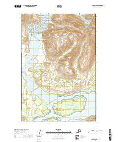
2017 Map of Juneau D-6 NW
USGS Topo · Published 2017About this map
Glacier Bay National Park dominates this 2017 study of the Southeast Alaskan wilderness, where the landscape is defined by massive peaks and glacial-carved corridors. The northern portion of the quadrangle is anchored by the prominent elevations of Snow Dome and Mt Elder, while the southeastern corner is marked by the deep cut of Granite Canyon. This map captures a transition between high alpine ridges and the complex system of inlets and wetlands that characterize the coastal boundaries of the Hoonah-Angoon Census Area. The absence of roads or permanent settlements highlights the protected and primitive state of the park as it appeared in the early 21st century.
Find a feature on this map
8 named features on this map. Tap any name to fly to it.
Don’t see what you’re looking for? This feature index may not catch every label — zoom into the map to look around manually.
Map Details
Editions of this 2017 Juneau D-6 NW Map
This is the sole edition of this map. No revisions or reprints were ever made.
Other maps of this area

1948 · Mount Fairweather D-1
USGS Topo · 1:63,360

1949 · Juneau D-6
USGS Topo · 1:63,360

1951 · Juneau
USGS Topo · 1:250,000

1951 · Mt Fairweather
USGS Topo · 1:250,000

1952 · Skagway
USGS Topo · 1:250,000

1954 · Mount Fairweather D-1
USGS Topo · 1:63,360

1954 · Skagway A-3
USGS Topo · 1:63,360

1961 · Mt Fairweather
USGS Topo · 1:250,000

1961 · Skagway
USGS Topo · 1:250,000

1962 · Juneau
USGS Topo · 1:250,000