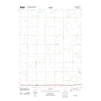
2012 Map of Juniata
USGS Topo · Published 2012About this map
The Saline River winds through the northern reaches of this central Kansas landscape, where the settlement of Juniata stands as a primary point of reference. The terrain is defined by a dendritic drainage network, with Table Rock Cr and Owl Cr carving through the prairie toward the river valley. To the south, the community of Glendale serves as another local hub, situated near the meandering path of Mulberry Cr. A well-defined grid of section roads, including McGavern Rd and Westfall Rd, organizes the agricultural parcels and connects isolated farmsteads. Near the northwestern corner, Monroe Cemetery provides a specific site of interest for genealogists tracing early families who settled along the river breaks. The map illustrates a contemporary balance of rural infrastructure and natural watercourses, showing how early settlement patterns near these creeks have transitioned into a modernized agricultural grid.
Find a feature on this map
28 named features on this map. Tap any name to fly to it.
Don’t see what you’re looking for? This feature index may not catch every label — zoom into the map to look around manually.
Map Details
Editions of this 2012 Juniata Map
This is the sole edition of this map. No revisions or reprints were ever made.
Other maps of this area

1892 · Salina
USGS Topo · 1:125,000

1892 · Minneapolis
USGS Topo · 1:125,000

1894 · Ellsworth
USGS Topo · 1:125,000

1894 · Beloit
USGS Topo · 1:125,000

1942 · Salina
USGS Topo · 1:125,000

1955 · Brookville
USGS Topo · 1:24,000

1955 · Culver
USGS Topo · 1:24,000

1955 · Manhattan
USGS Topo · 1:250,000

1955 · Great Bend
USGS Topo · 1:250,000

1955 · Hutchinson
USGS Topo · 1:250,000