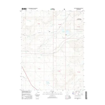
2016 Map of Juniata Reservoir
USGS Topo · Published 2016About this map
Juniata Reservoir and the adjacent Hallenbeck Reservoir serve as the centerpiece of this 2016 survey, illustrating the complex irrigation and water storage network required for the high-altitude agriculture of western Colorado. The landscape is defined by the broad, flat-topped formations of Purdy Mesa and Reeder Mesa, where early ranching infrastructure is still visible through the labyrinth of named waterways such as the Lander Extension Ditch and the Brown and Campion Ditch. To the east, the terrain rises into the edge of the Grand Mesa National Forest, where the topography becomes more varied. This area showcases the critical engineering of the early 20th century that diverted mountain runoff from Kannah Cr and Indian Cr to sustain the orchards and ranches of the valley floor, a system that remains vital to the region's geography.
Find a feature on this map
38 named features on this map. Tap any name to fly to it.
Don’t see what you’re looking for? This feature index may not catch every label — zoom into the map to look around manually.
Map Details
Editions of this 2016 Juniata Reservoir Map
This is the sole edition of this map. No revisions or reprints were ever made.
Other maps of this area

1956 · Moab
USGS Topo · 1:250,000

1956 · Grand Junction
USGS Topo · 1:250,000

1959 · Grand Junction
USGS Topo · 1:250,000

1959 · Moab
USGS Topo · 1:250,000

1960 · Moab
USGS Topo · 1:250,000

1960 · Grand Junction
USGS Topo · 1:250,000

1962 · Moab
USGS Topo · 1:250,000

1962 · Grand Junction
USGS Topo · 1:250,000

1962 · Clifton
USGS Topo · 1:24,000
1962 · Lands End
USGS Topo · 1:24,000