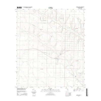
2015 Map of Juniper Creek
USGS Topo · Published 2015About this map
Juniper Creek flows through the center of this Calhoun County landscape, defined by a complex network of wetlands and tributaries. The terrain is marked by distinctive swampy features known as "heads," including Calder Head, Hickory Head, and Buck Head, which serve as the origins for various branches. These hydrologic patterns dictate the layout of rural infrastructure, with small private airstrips like the Ron Wood Airport and Steep Head Farm Airport situated on relatively higher ground.
Find a feature on this map
48 named features on this map. Tap any name to fly to it.
Don’t see what you’re looking for? This feature index may not catch every label — zoom into the map to look around manually.
Map Details
Editions of this 2015 Juniper Creek Map
This is the sole edition of this map. No revisions or reprints were ever made.
Other maps of this area

1944 · Clarksville
USGS Topo · 1:31,680

1945 · Juniper Creek
USGS Topo · 1:31,680

1945 · Youngstown
USGS Topo · 1:31,680

1945 · Clarksville
USGS Topo · 1:31,680

1945 · Broad Branch
USGS Topo · 1:31,680

1945 · Frink
USGS Topo · 1:31,680

1945 · Fountain
USGS Topo · 1:31,680

1952 · Alford SE
USGS Topo · 1:24,000

1952 · Altha West
USGS Topo · 1:24,000
1952 · Compass Lake
USGS Topo · 1:24,000