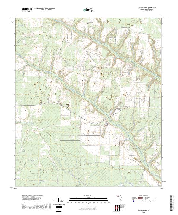
2024 Map of Juniper Creek
USGS Topo · Published 2024About this map
Juniper Creek and its many winding tributaries, including Centerfit Branch and Watson Branch, dominate this section of Calhoun County. The landscape is defined by the unique topography of "heads" and "bays," such as Hickory Head, Steep Head, and the expansive Big Bear Bay in the northwest. These features suggest a complex wetland system and traditional Florida panhandle drainage patterns, leading south toward Buzzard Bay Swamp.
Find a feature on this map
50 named features on this map. Tap any name to fly to it.
Don’t see what you’re looking for? This feature index may not catch every label — zoom into the map to look around manually.
Map Details
Editions of this 2024 Juniper Creek Map
This is the sole edition of this map. No revisions or reprints were ever made.
Other maps of this area

1944 · Clarksville
USGS Topo · 1:31,680

1945 · Juniper Creek
USGS Topo · 1:31,680

1945 · Youngstown
USGS Topo · 1:31,680

1945 · Clarksville
USGS Topo · 1:31,680

1945 · Broad Branch
USGS Topo · 1:31,680

1945 · Frink
USGS Topo · 1:31,680

1945 · Fountain
USGS Topo · 1:31,680

1952 · Alford SE
USGS Topo · 1:24,000

1952 · Altha West
USGS Topo · 1:24,000
1952 · Compass Lake
USGS Topo · 1:24,000